Fall in the White Mountains, Part 2
After an easy day of leaf peeping in the White Mountains, we decided to tackle a longer hike in search of wide vistas. (If you haven’t yet, take a look at Part 1.)
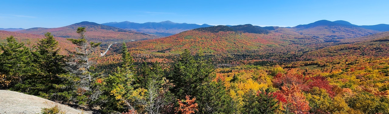
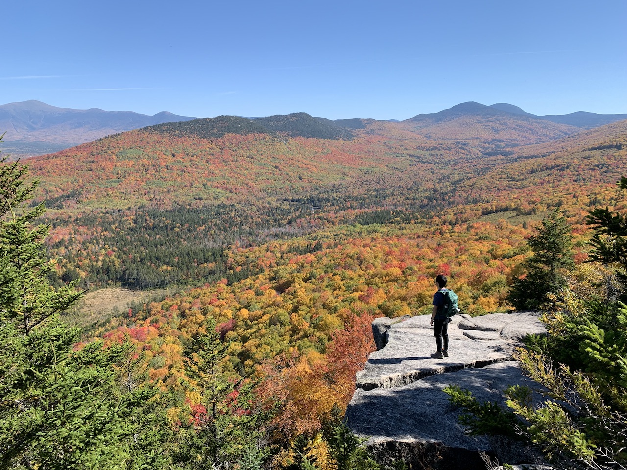
Sugarloaf Trail
The Sugarloaf Trail is located northwest of the Franconia Notch. Driving from Lincoln, New Hampshire, the Presidential Range and Mt. Washington can be seen looming in the distance. By the time we got there around 10 AM in the morning, the parking lot was full and there were plenty of cars parked up on one side of the street.
We did the hike up North and Middle Sugarloaf. The trail starts out along the Zealand River before rapidly ascending in the woods. Annoyingly, there is a sizable descent before another ascent to the peak of North Sugarloaf. When we reached the top of North Sugarloaf, we were rewarded with fantastic east-facing views of the fall foliage (which more than made up for the descent), as well as the Presidentials in the distance. You can occassionally see the large smoke plume rising from the train that travels up Mt. Washington.
Make sure to poke around for trails that lead to the south face of North Sugarloaf, because there are some excellent views to be had there as well.
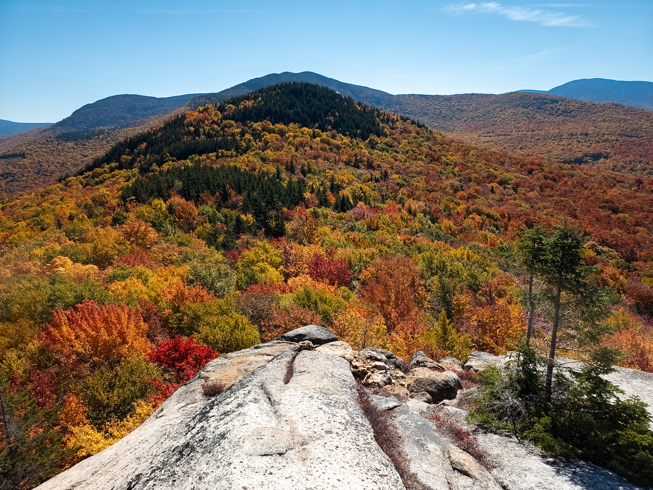
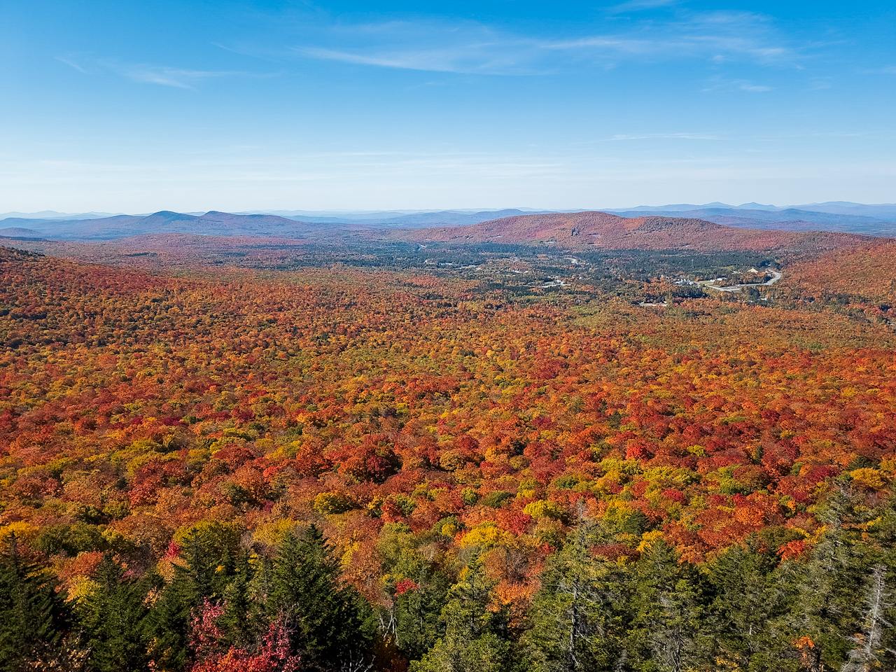
Afterwards we headed for Middle Sugarloaf. While you only get roughly 180 degrees of views from North Sugarloaf, you can get more than 270 degrees of vibrant orange-red foliage on east-, south-, and west-facing slopes of the peak.
I’m really happy that we picked this hike over the more popular Mt. Willard, as the value proposition (good views to effort ratio) of this hike is superior.
Pemigewasset Outlook
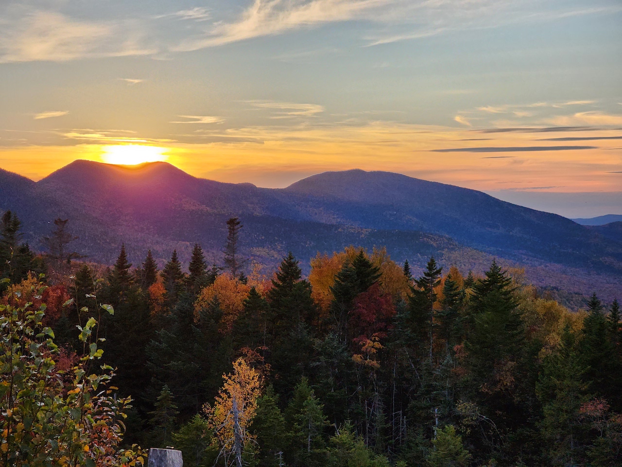
As we had a couple of hours of daylight left, we scurried over to the Pemigewasset Outlook to try and catch a sunset. I made the mistake of assuming that looping around to the outlook by going further eastward on 302 and then hopping on the Kancamagus would be about the same distance; in fact, I ended up driving an extra unnecessary 25 miles and got stuck in traffic in Conway! Plus, much of the foliage in this region was past peak. However, we passed through the majestic Crawford Notch, which wasn’t on our bucket list before, and ended up visiting there the following day… so mission successfully failed?
We were able to arrive at Pemigewasset Outlook just as the sun was setting over Mt. Osceola.
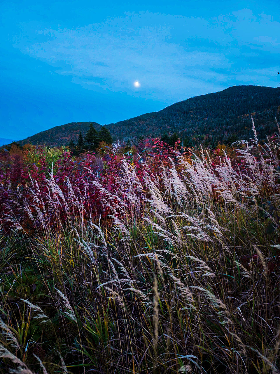
CL Graham Wangan Overlook
Just a minute’s drive away we were able to catch the moonrise as well. If you walk toward the path in the bushes below the parking lot (make sure you have long pants) you’ll be able to capture fall grasses and foliage in the foreground.
You can see a Google My Maps of the locations listed in this post series here.